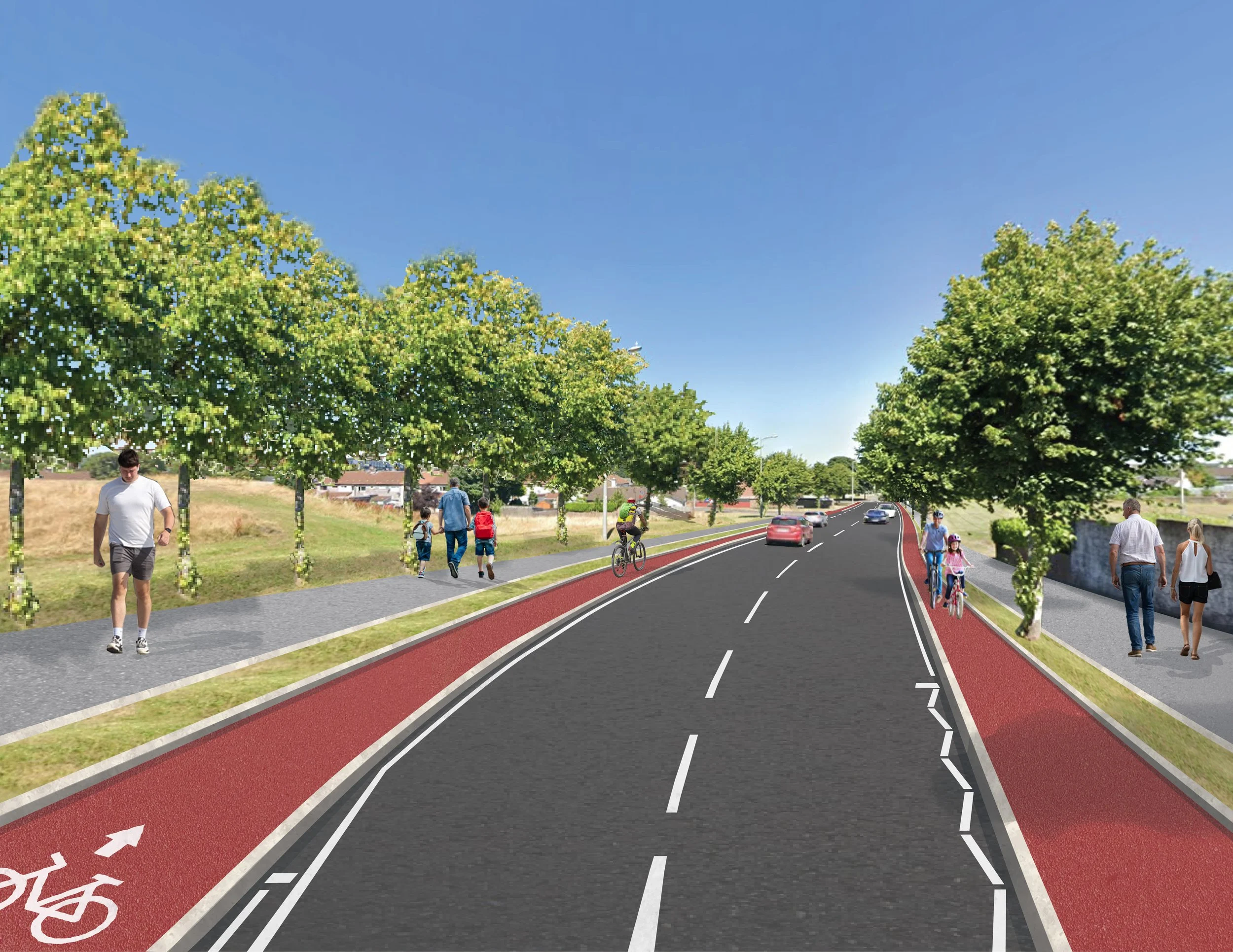
Design Collages
This body of work focuses on photomontage visualizations developed to communicate proposed public realm and infrastructure interventions. Working from CAD drawings supplied by engineers, alongside site photography, Google Maps imagery, and reference visuals, I translated technical proposals into realistic, accessible visual representations.
The aim was to help stakeholders, councilors, and the public better understand how projects would sit within the existing environment, bridging the gap between technical planning documents and real-world context.
Process
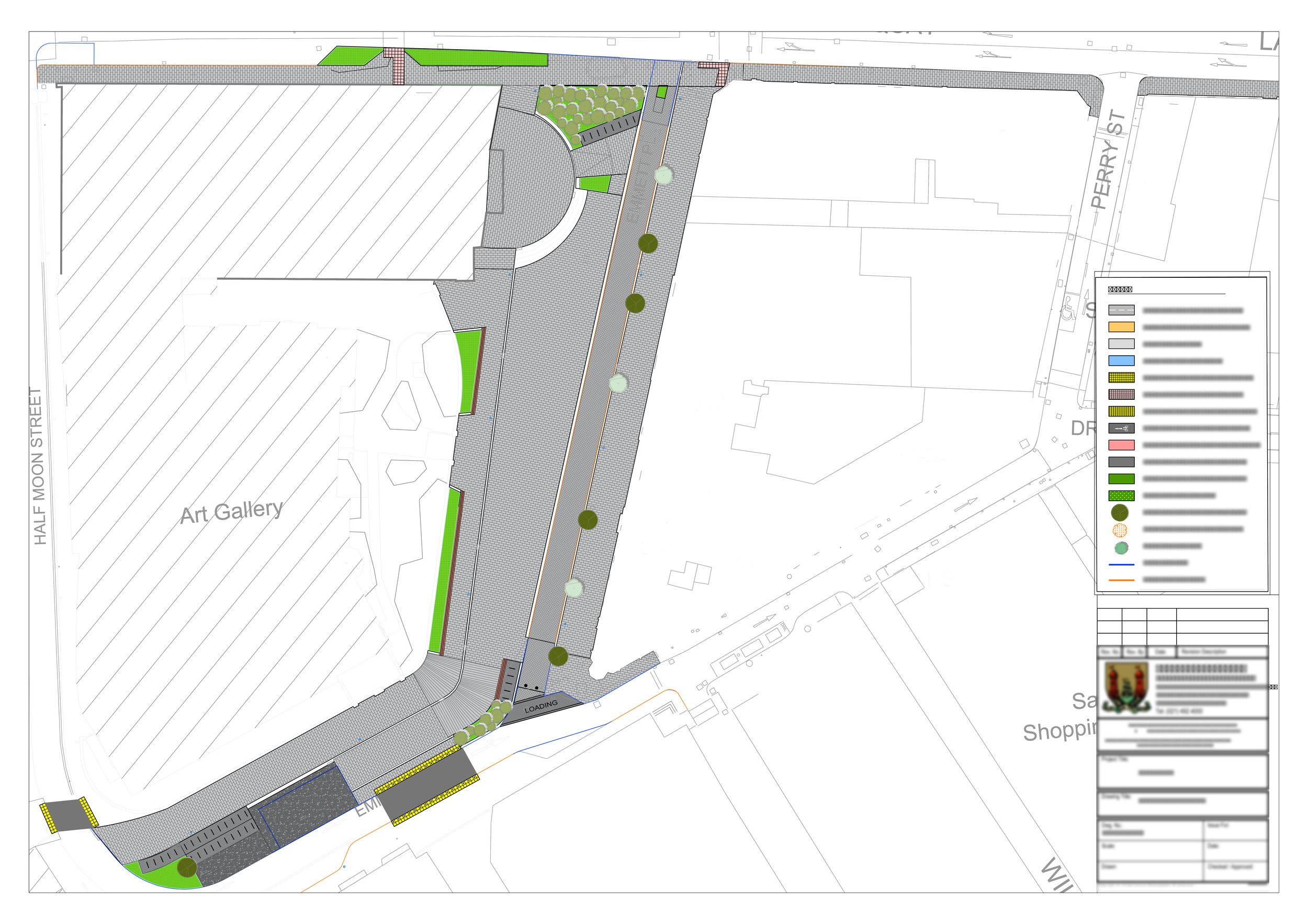
Each visualization begins with a CAD base drawing supplied by the engineering or planning team, defining dimensions, layout, and technical intent.
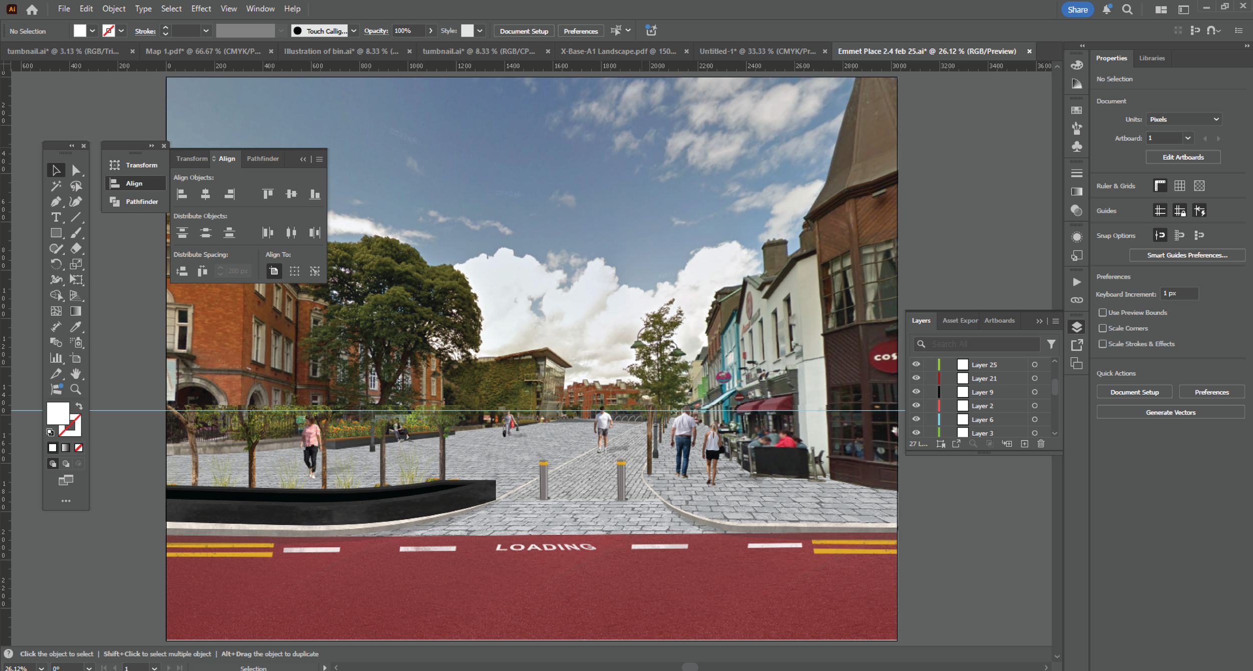
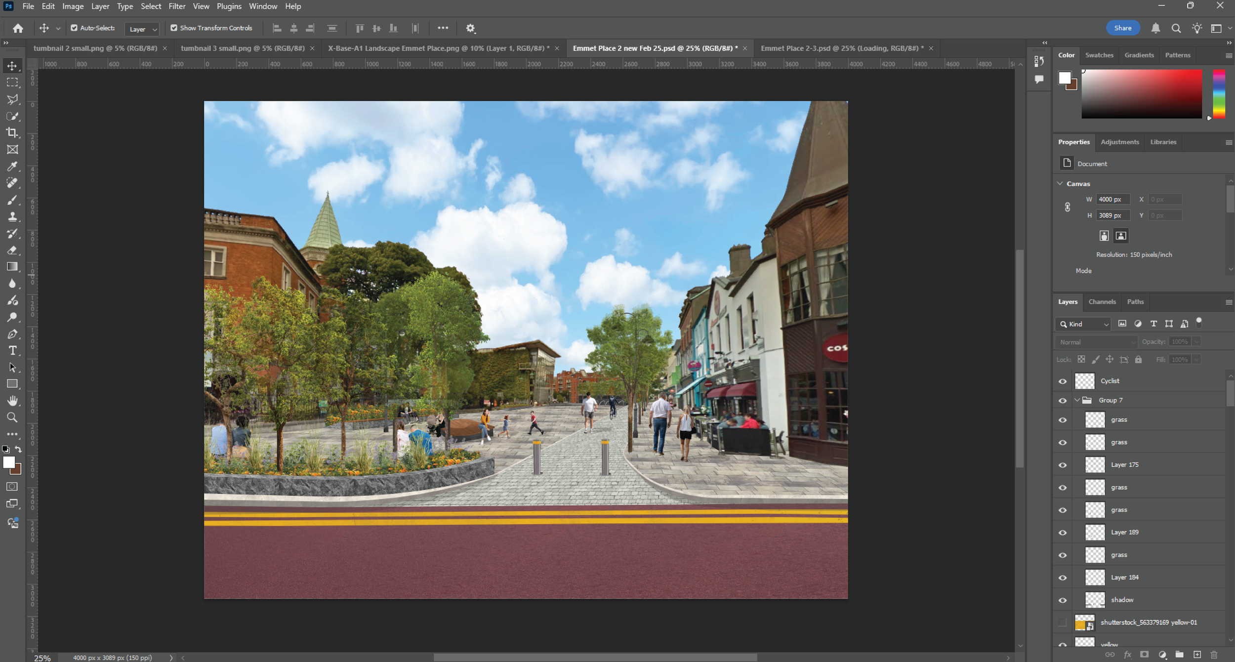
Using Google Maps imagery, site photography, and supplied reference images, I then build the scene in layers—integrating landscape elements, materials, street furniture, planting, and surrounding context to create a realistic representation of the proposed design.
This process combines technical precision with visual storytelling, transforming highly complex information into clear, engaging imagery that supports decision-making and public consultation.


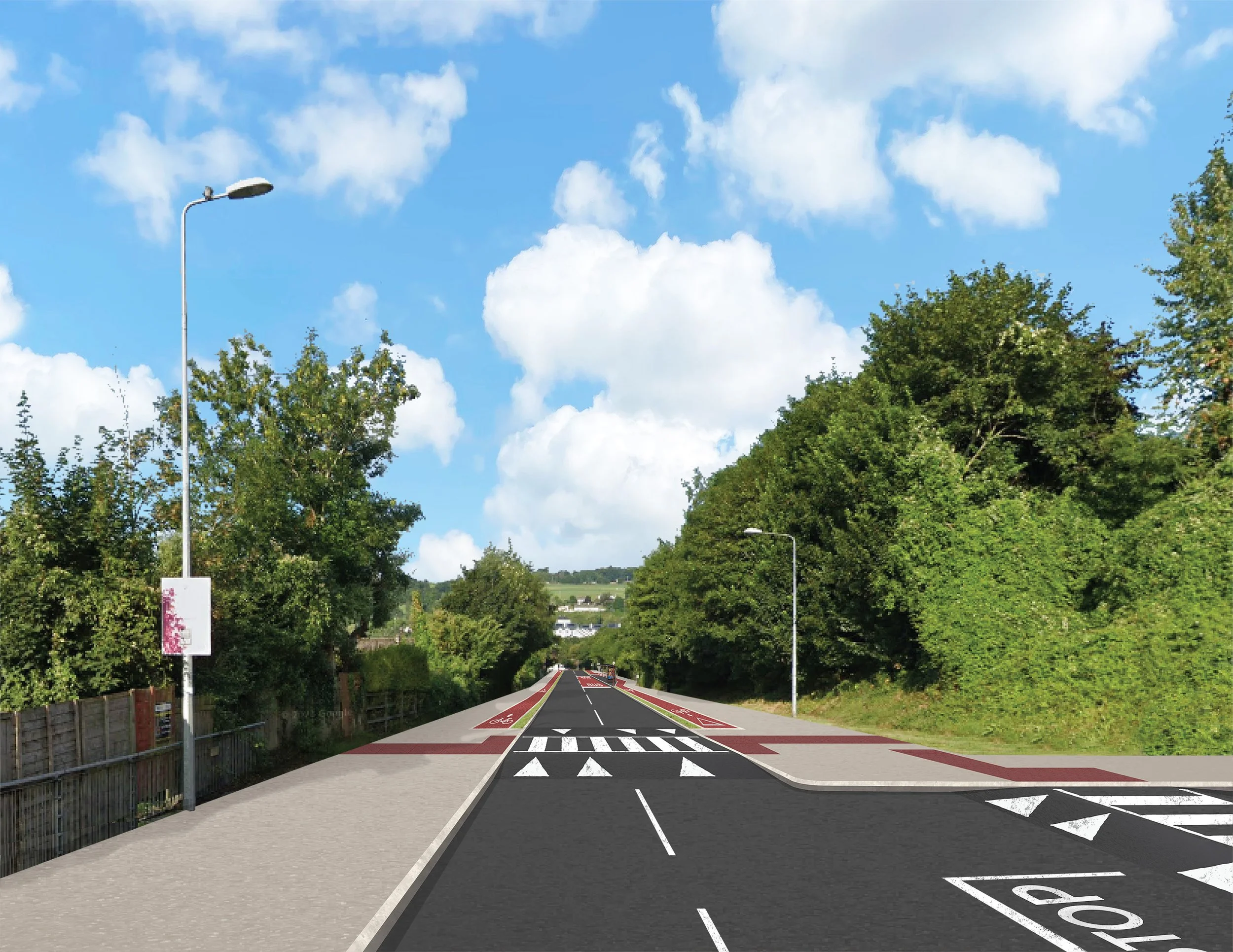
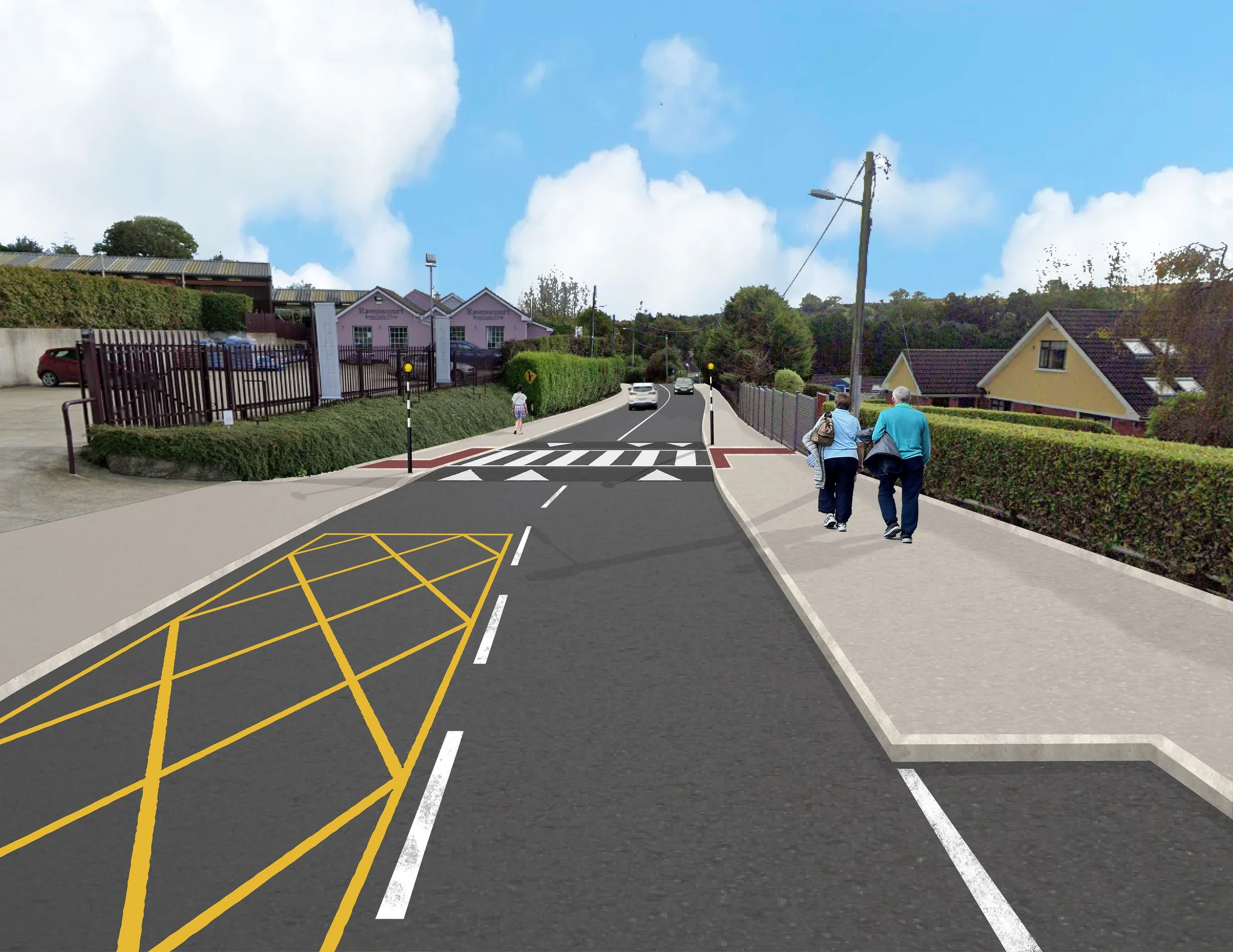
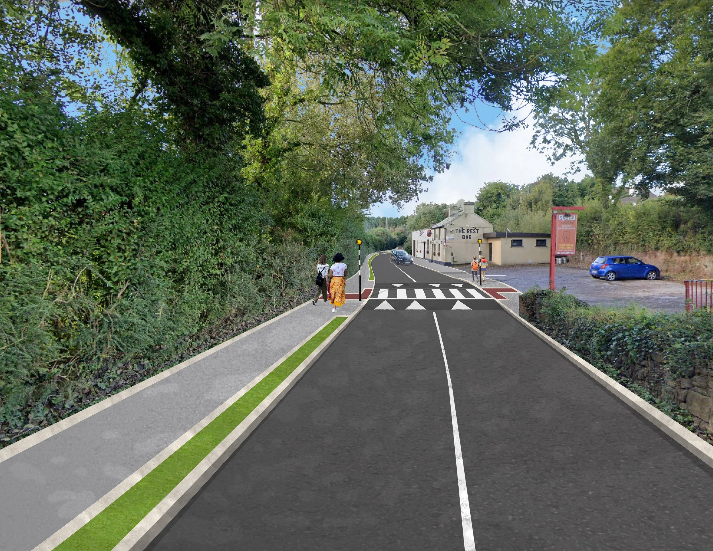
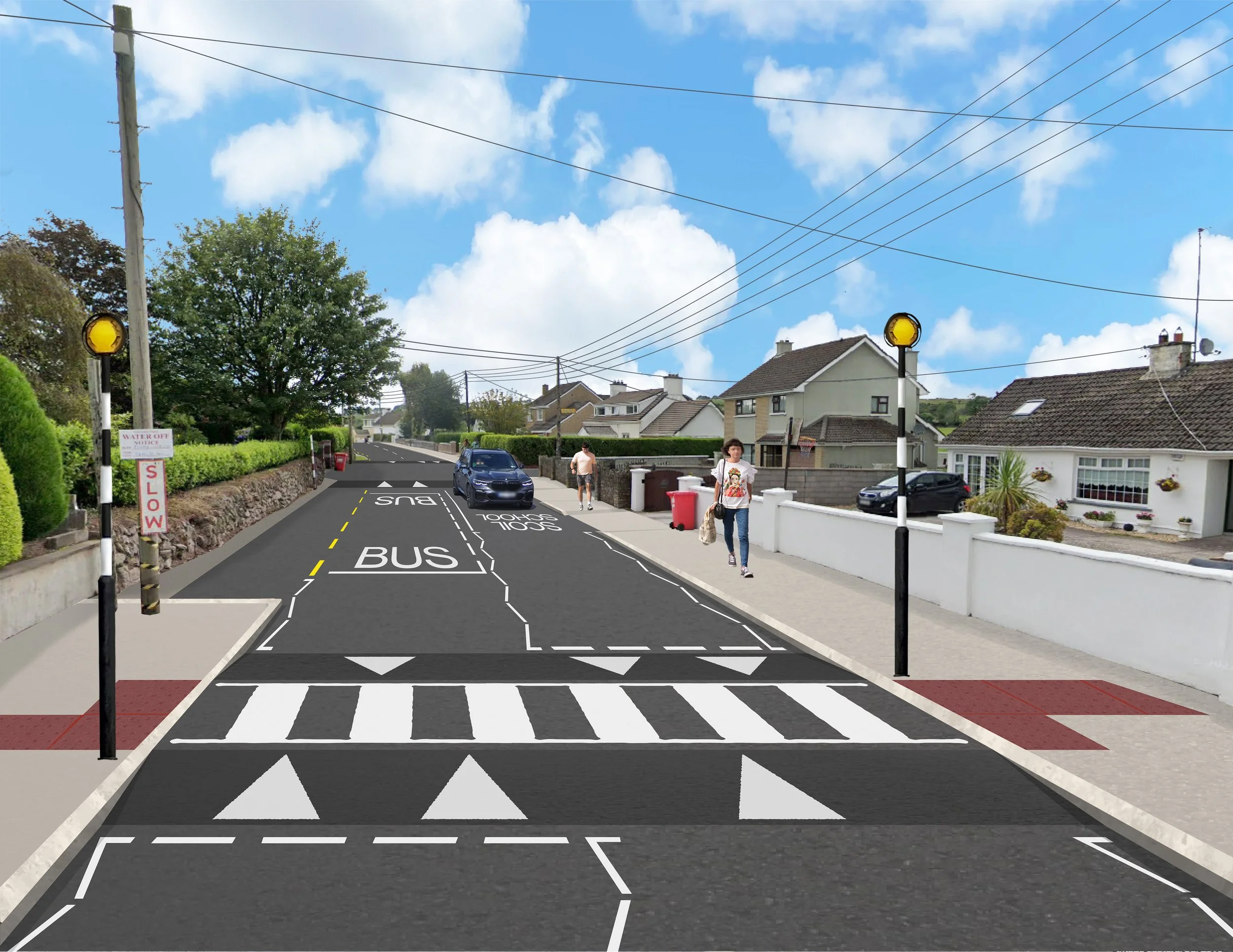
Selection of Design Collages
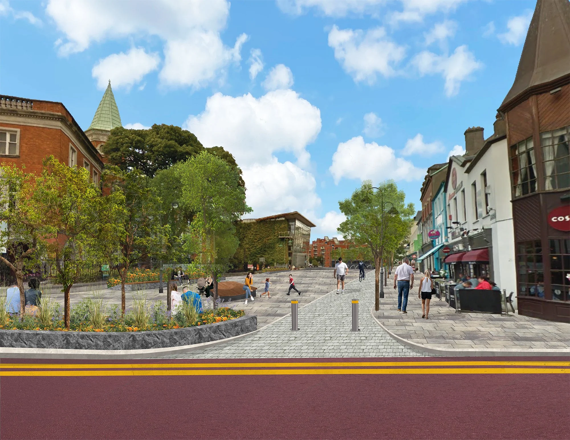
The examples below show the progression from technical CAD source material to completed photomontage.
Each final image is designed to clearly communicate scale, atmosphere, and context, helping non-technical audiences visualize proposed changes within the public realm.
These visuals were used across public consultation, internal planning reviews, and stakeholder presentations, strengthening confidence and improving understanding of the proposed works.

Allendale Foxford Ave Junction

Fairfield Ave Roundabout

Bessboro Road Area 1

Bessboro Road Area 2
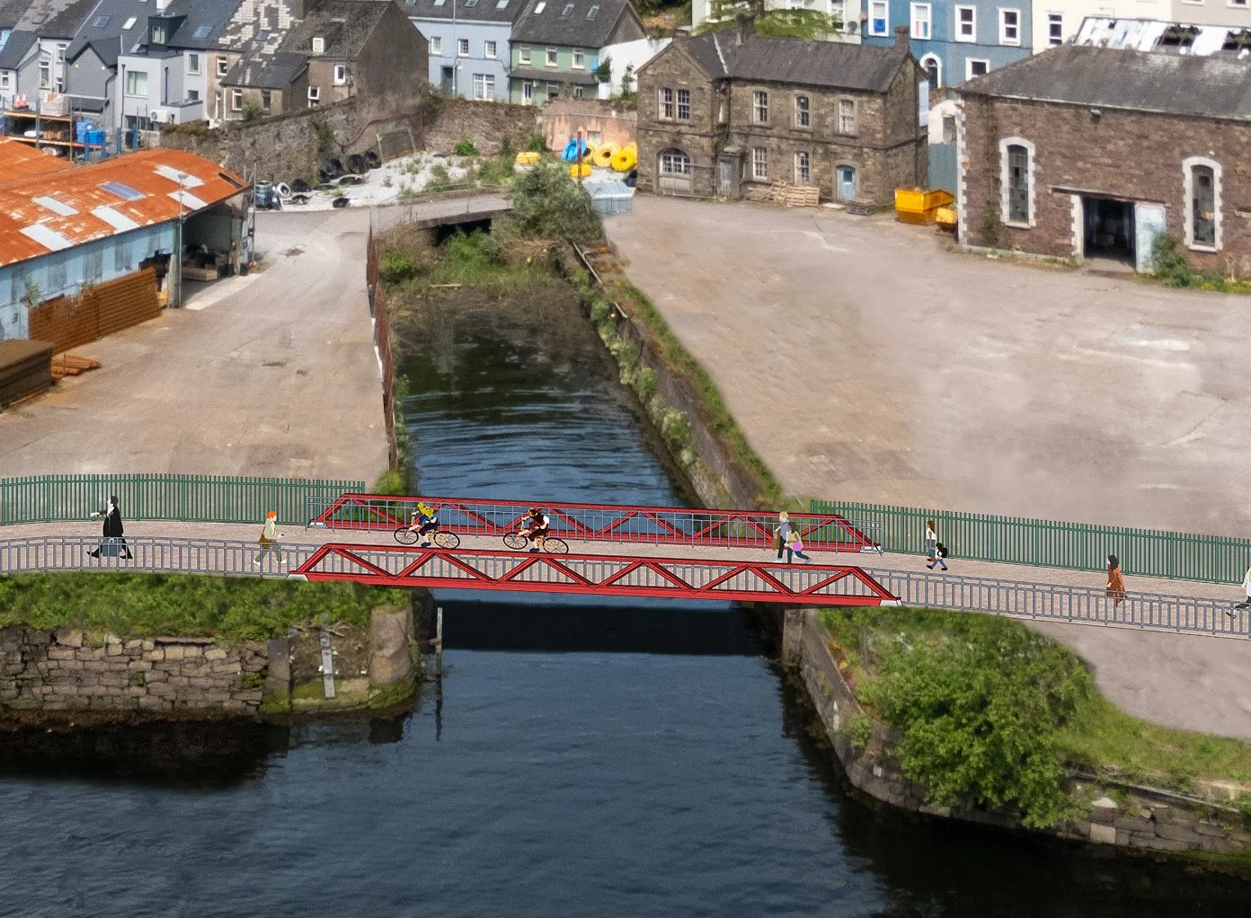
Blarney Footbridge option 1
Blarney Footbridge option 2

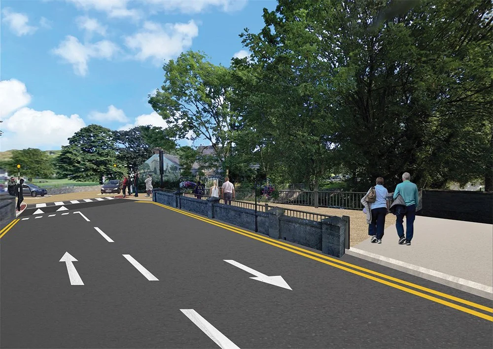
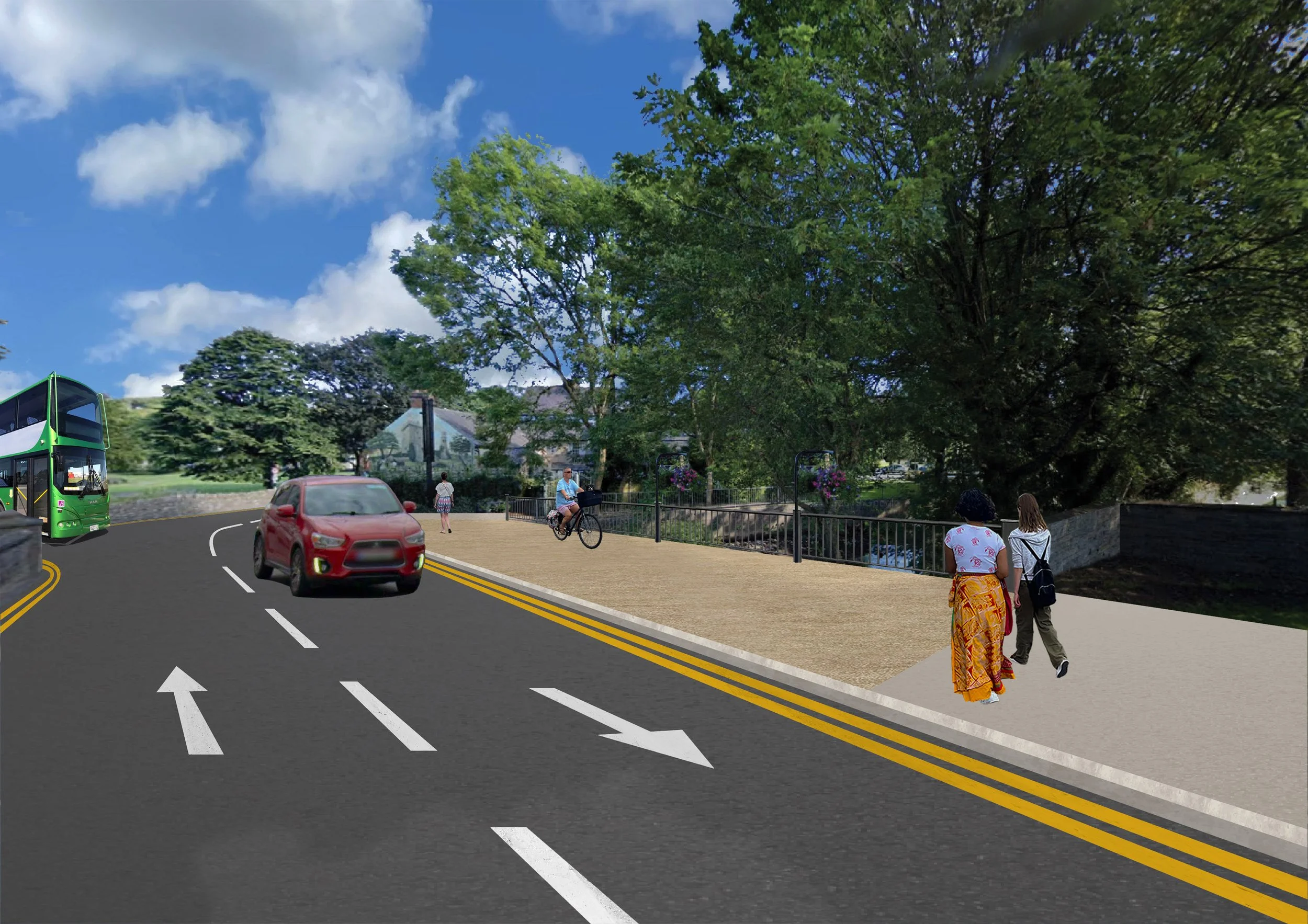
Blarney Waterloo Road
Lower Glanmire Road Footbridge
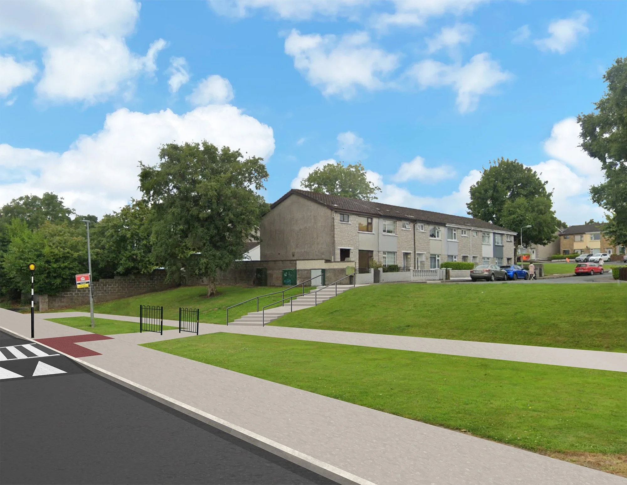
Cooney's Lane, Hollyville Estate

Emmet Place South view 1

Emmet Place South view 2

Emmet Place North view 1

Emmet Place North view 2

Emmet Place North view 3

Emmet Place North view 4

Emmet Place North view 5

Finnbarre's Bridge

Glanmire, Cliff Road north view

Glanmire, Hazelwood Road South view
Glanmire, Hazelwood Road East view
Kerry Pike Area 1
Kerry Pike Area 2
Kerry Pike Area 3

Maryborough Woods
Ringmahon Road

Rossa Ave and Allendale Ave

Shanakiel